Hi!
I'm Oliviana Summers
I'm Oliviana Summers
I'm passionate about building resilient and dynamic cities that reflect a diverse population.
Currently, I'm in my final semester for a post-degree diploma in Applied Planning at Langara College-- a program where working professionals teach us how to do the hands-on work across a wide variety of disciplines. Planning intrinsically builds on my background of a Bachelor's in Urban Forestry from the University of British Columbia, as incorporating environmental factors into urban environments takes multidisciplinary teamwork, public support, and time. Growing up in Metro Vancouver, I take great pride in our access to abundant natural spaces alongside a cohesive transit network to get me practically anywhere I want to go. It's my goal to ensure those aspects, cherished since I was young, only get better for the generations to follow.
My skills in creative and technical programs such as Photoshop, Illustrator, Indesign, Affinity, ArcGIS Pro, and AutoCAD allow me to perform a wide variety of projects with proficiency. I'm naturally drawn to leadership roles, and my organizational skills allow me to excel in them. My leadership style prioritizes meeting deadlines while remaining flexible to allow for inclusive collaboration and dynamic project timelines.
Below, you'll find a collection of works I've developed--both solo and in collaboration with my peers. I'm proud to showcase this work as a demonstration of my familiarity with different types of projects, with a strong focus on visual impact and clear language.
Let's Connect!
Use the form below to send me an email.
We'll be in touch!
Resume
My resume outlines my experiences throughout my educational and professional career alongside the skills I've acquired throughout.
Please feel free to download a copy should you be interested.
Portfolio
Maps, Drawings, & Infographics
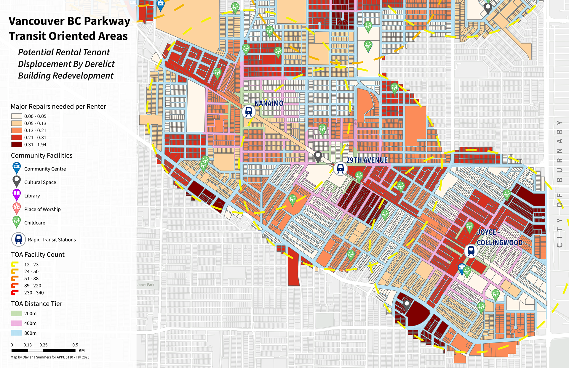
A map analyzing potential tenant displacement through redevelopment at Skytrain TOAs along the BC Parkway.
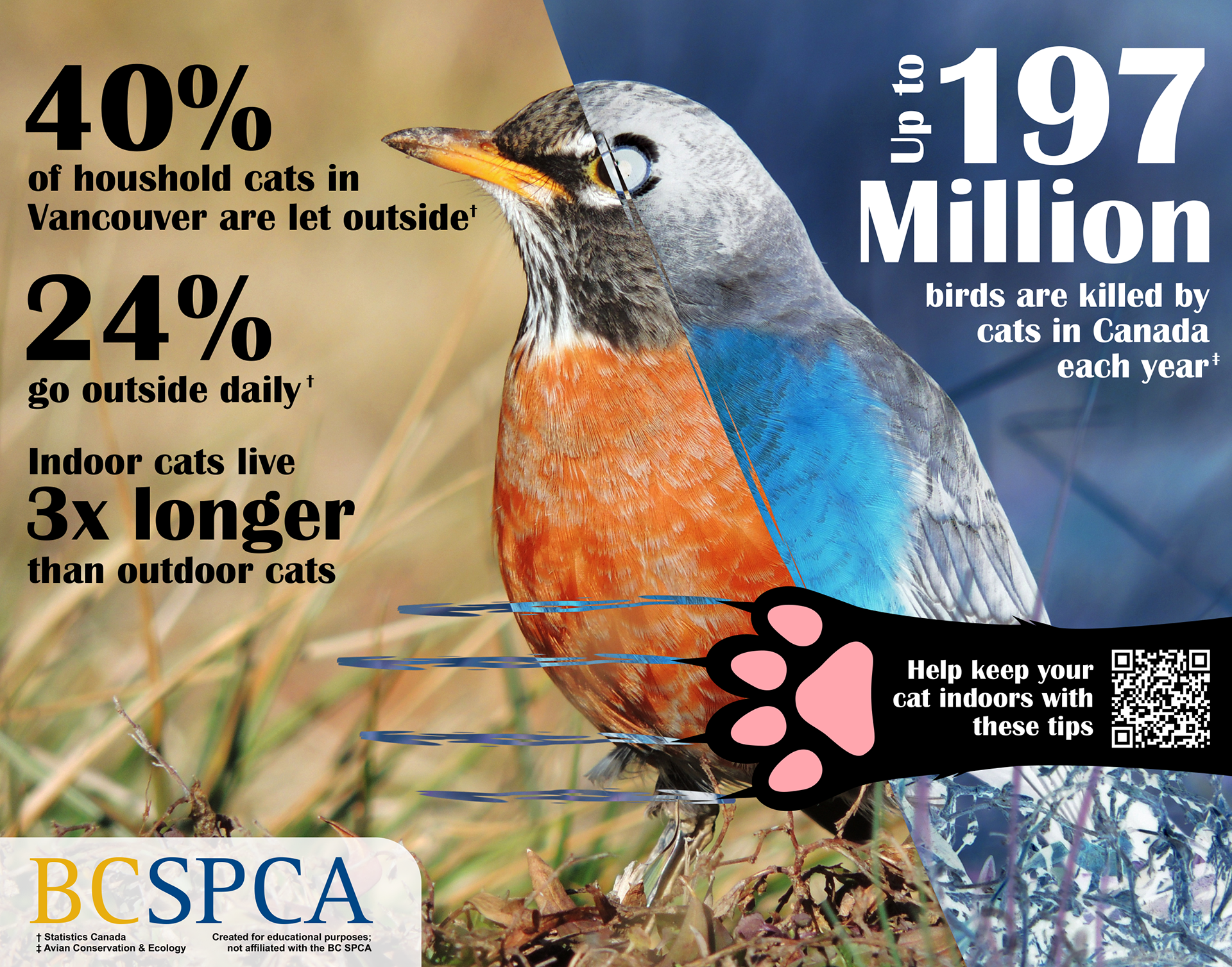
A hypothetical infographic for the BC SPCA to encourage keeping cats indoors.
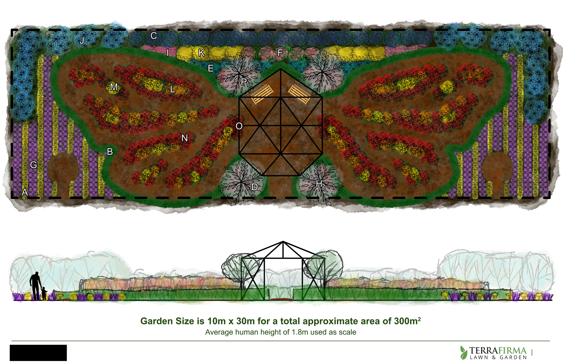
A large-scale garden design featuring a butterfly motif for a private client in Langley Township.
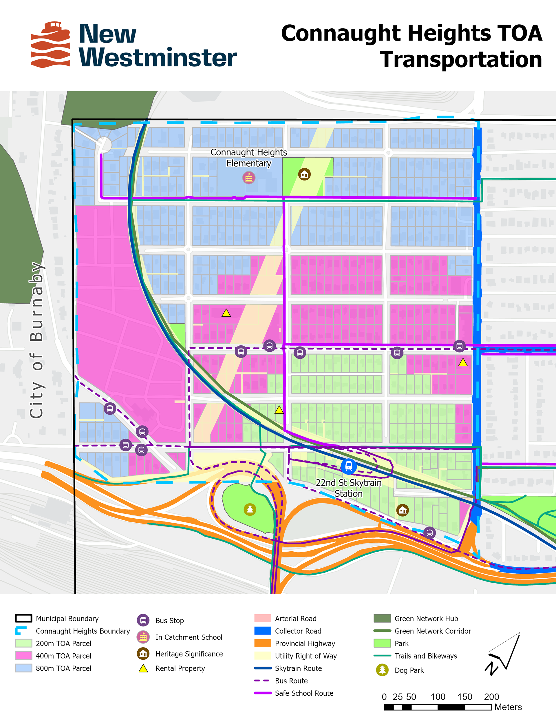
A map showcasing the parcels within Connaught Heights, New Westminster, affected by the 22nd Street Skytrain TOA buffers alongside the existing transportation network.
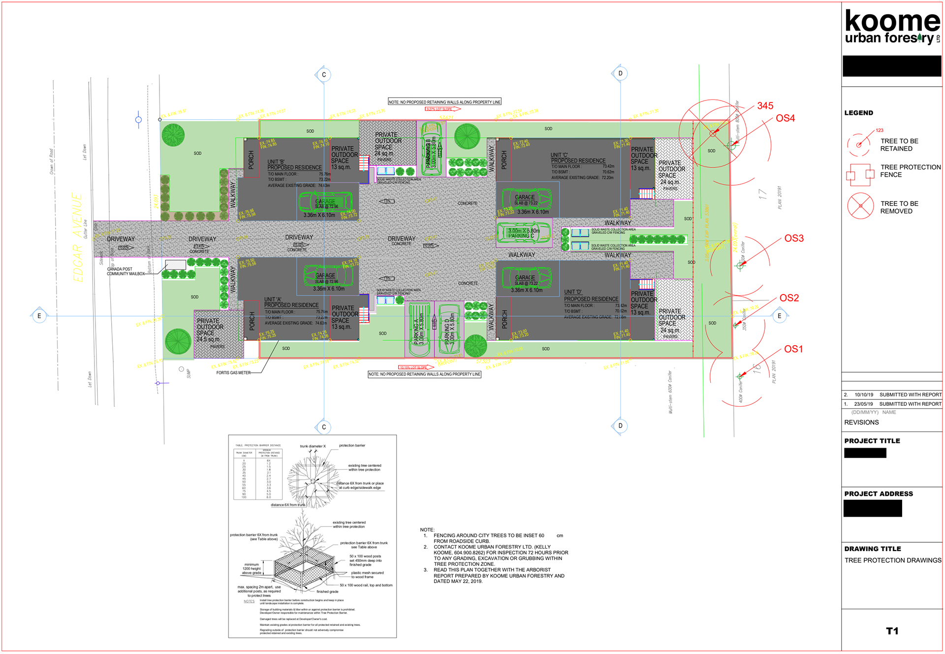
Tree Retention Plan Project for a Development Application.
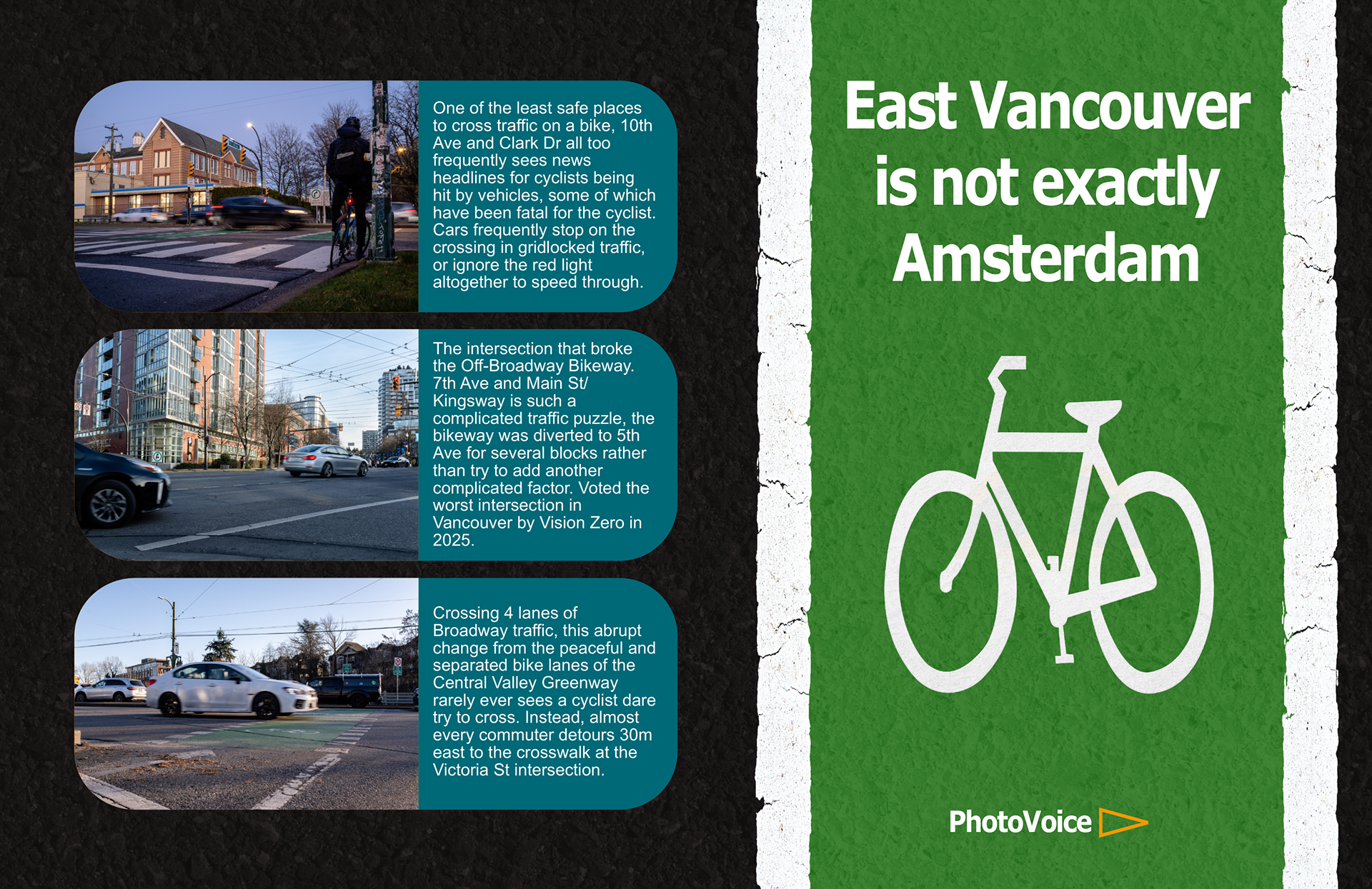
An infographic identifying three problematic cycling intersections located in East Vancouver in collaboration with the non-profit PhotoVoice.
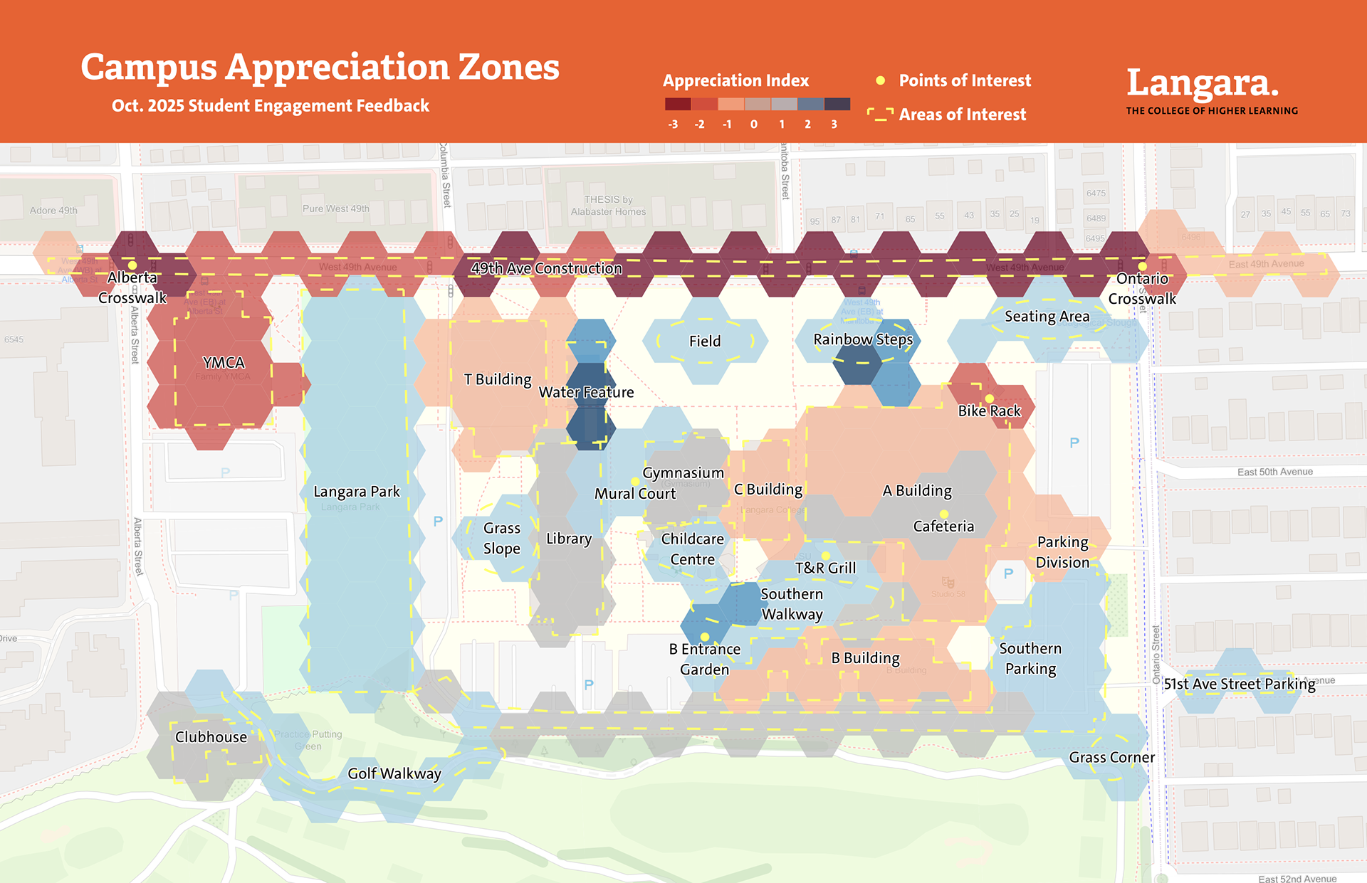
A visualization of survey results for favourable or dissatisfied zones on the main Vancouver campus of Langara College.
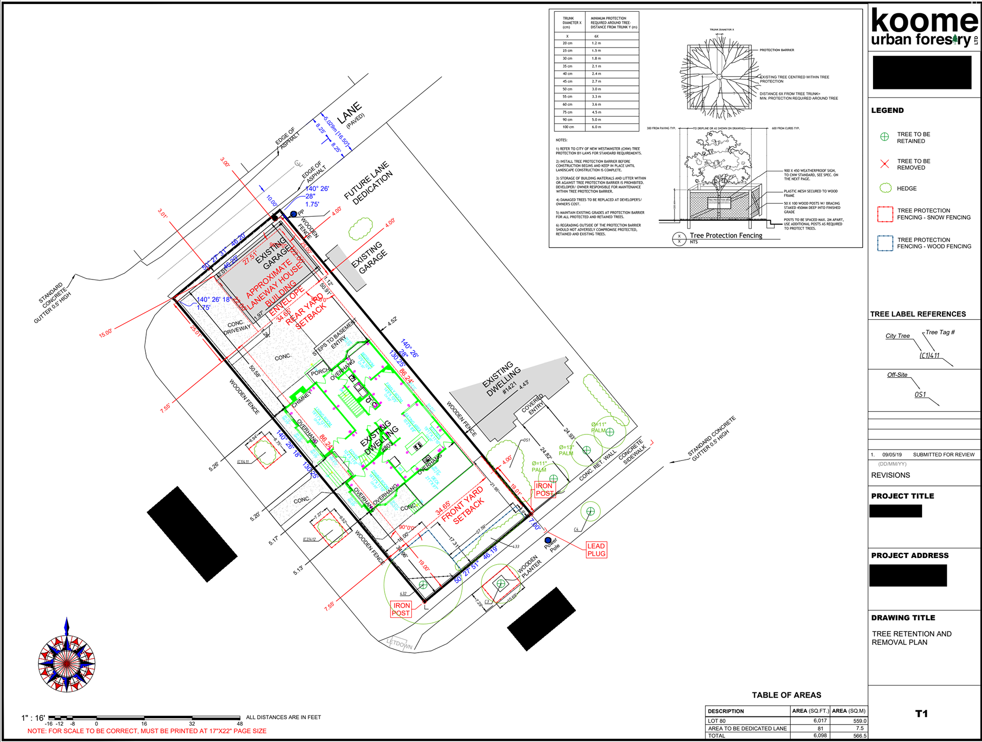
Tree Retention Plan Project for a Development Application.
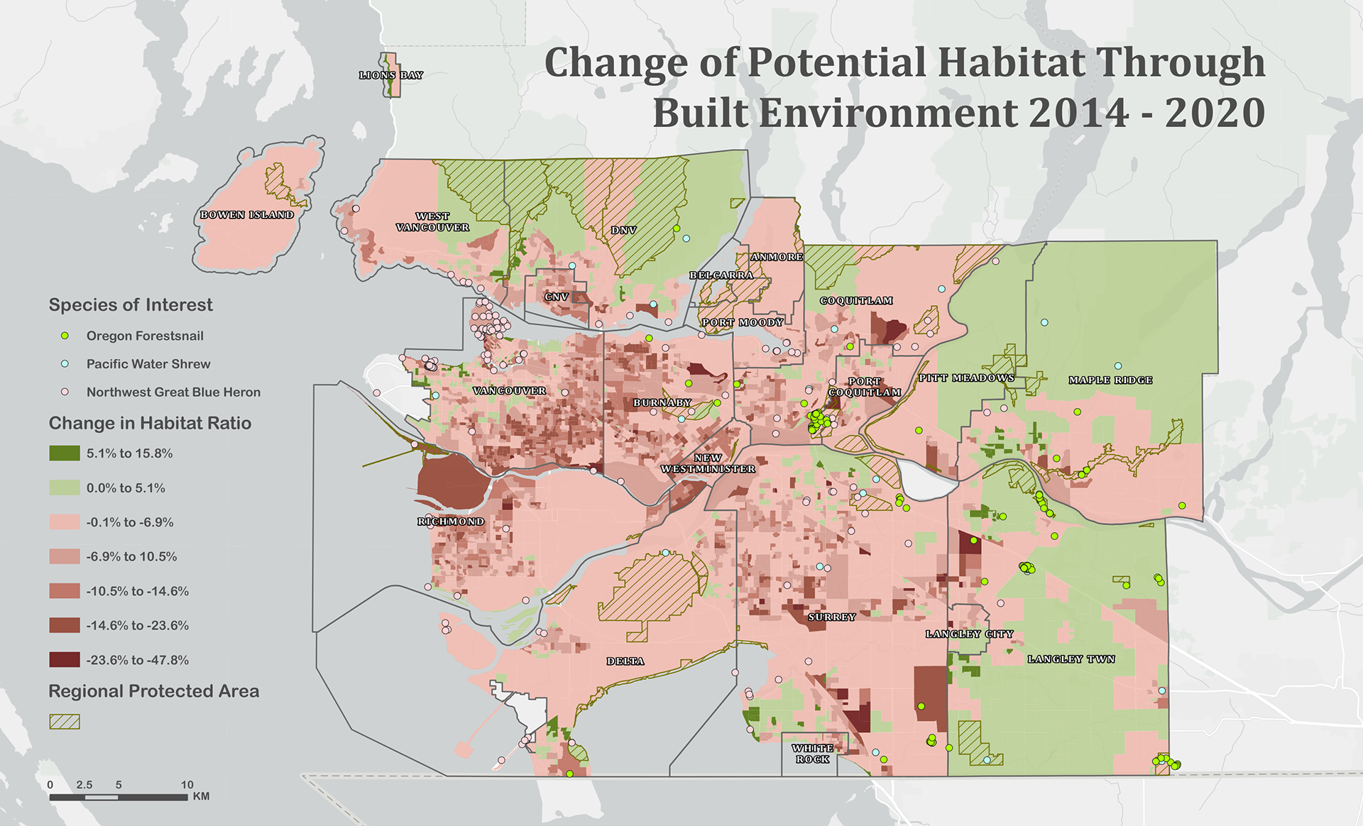
A map showcasing changes in potential habitat derived from increased development in Metro Vancouver, utilizing the location sightings of three endangered species as an analysis tool.
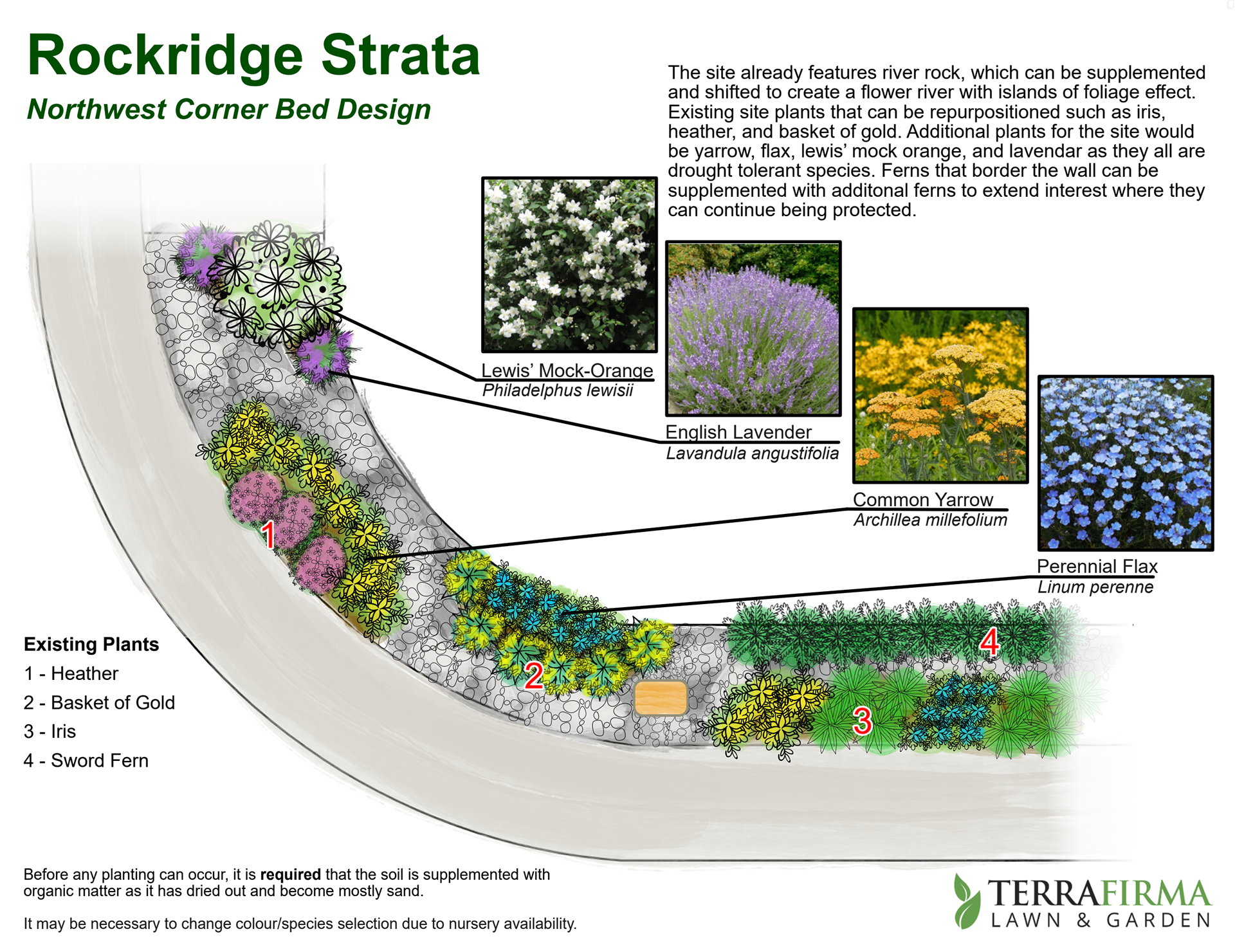
A street corner garden design for a strata client.
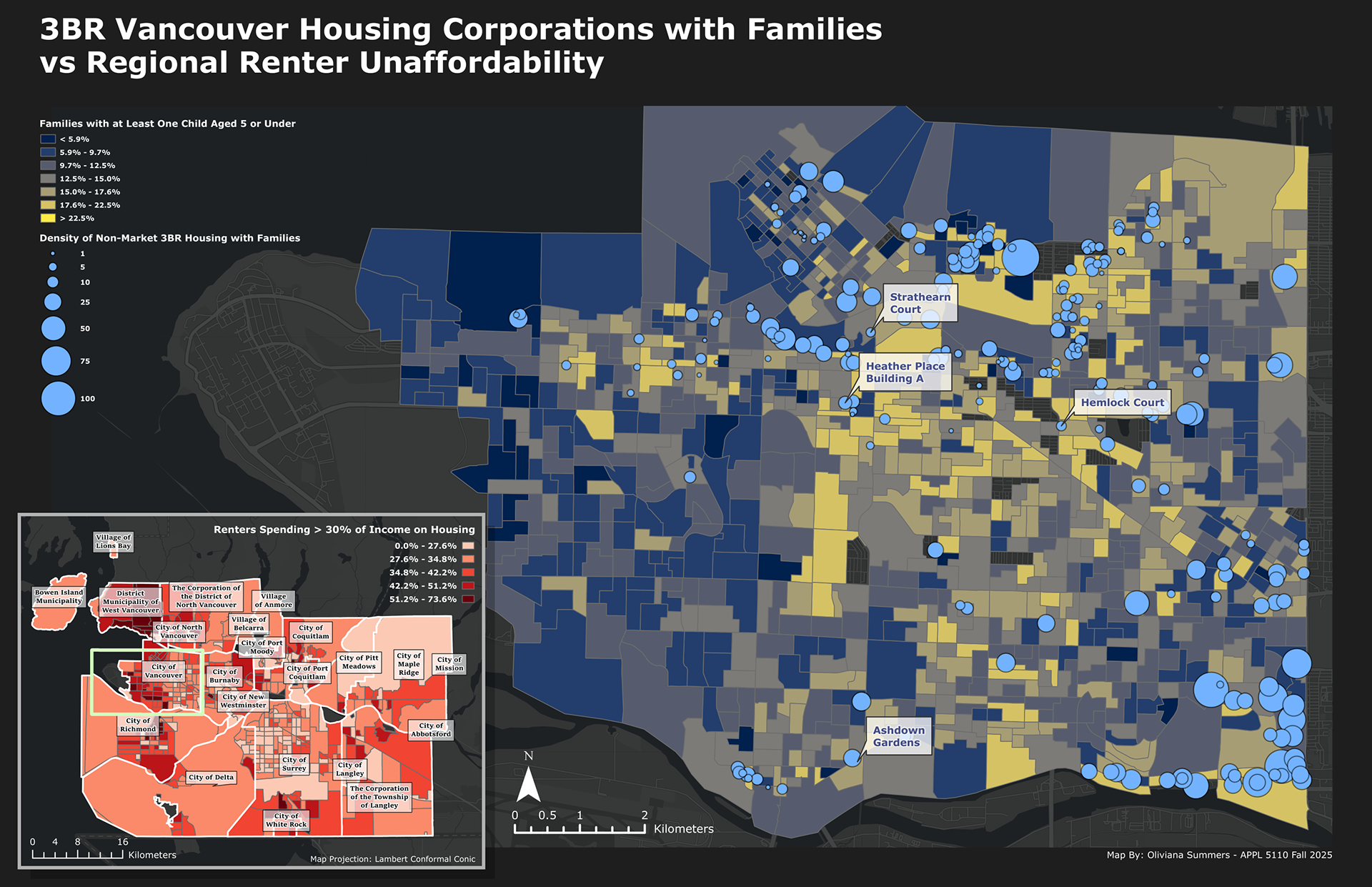
A map showcasing the location of 3BR co-op housing units in Vancouver alongside the density of families with young children, alongside a regional analysis of renter unaffordability.
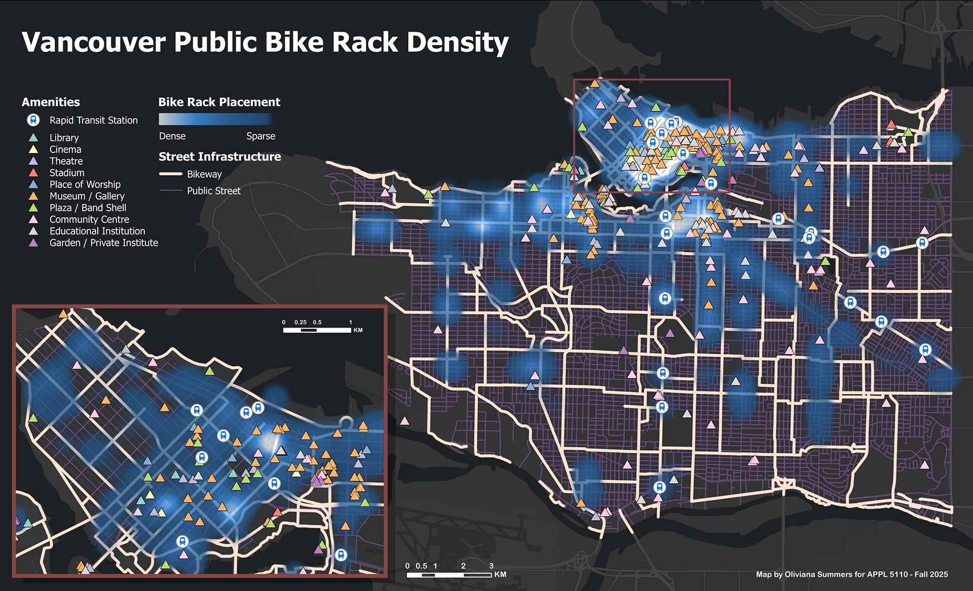
A map analyzing the density of public bike racks around city amenities and rapid transit stations.
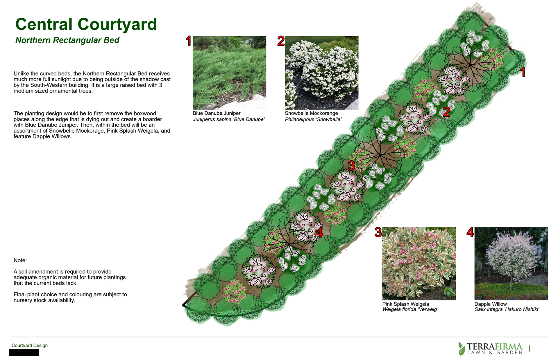
A central courtyard raised garden bed design for a strata property in Surrey.
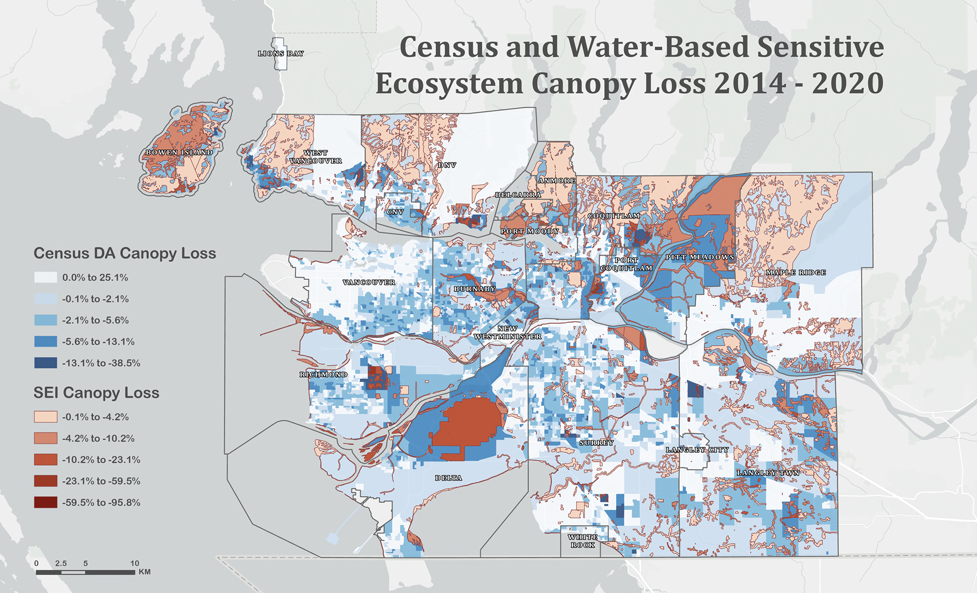
A map showcasing the changes in canopy coverage and how it relates to water-based sensitive ecosystems within Metro Vancouver.
Reports & Documents
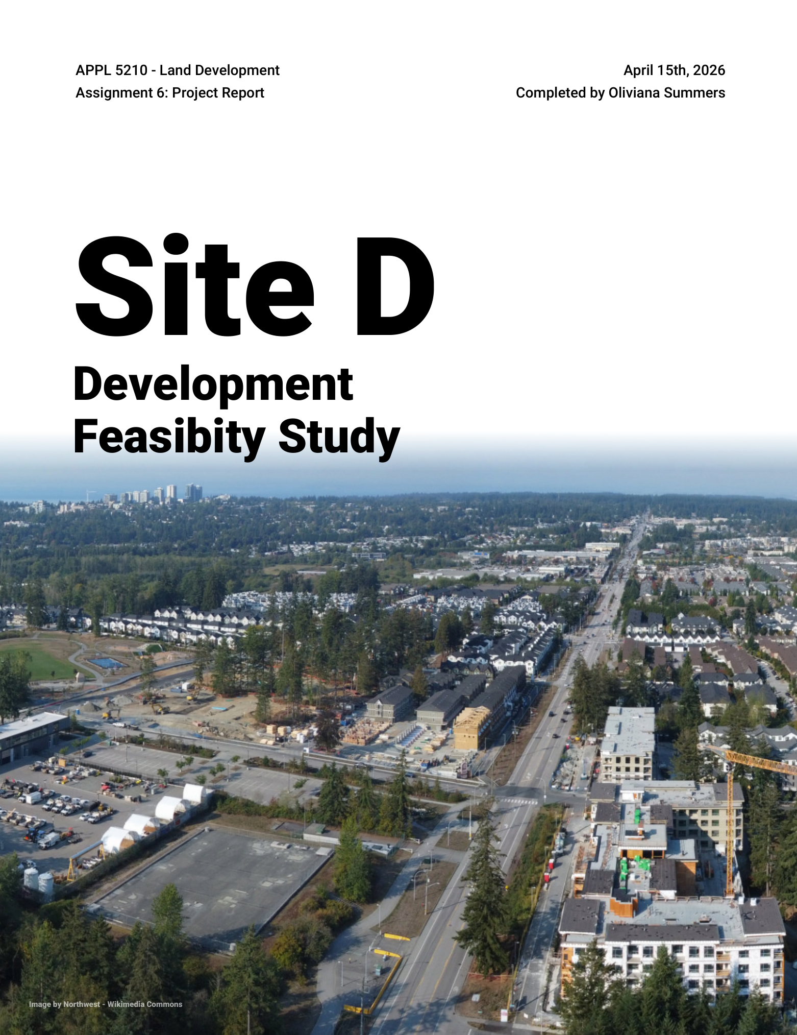
A hypothetical development feasibility study for a greenfield lot subdivision plan located in South Surrey
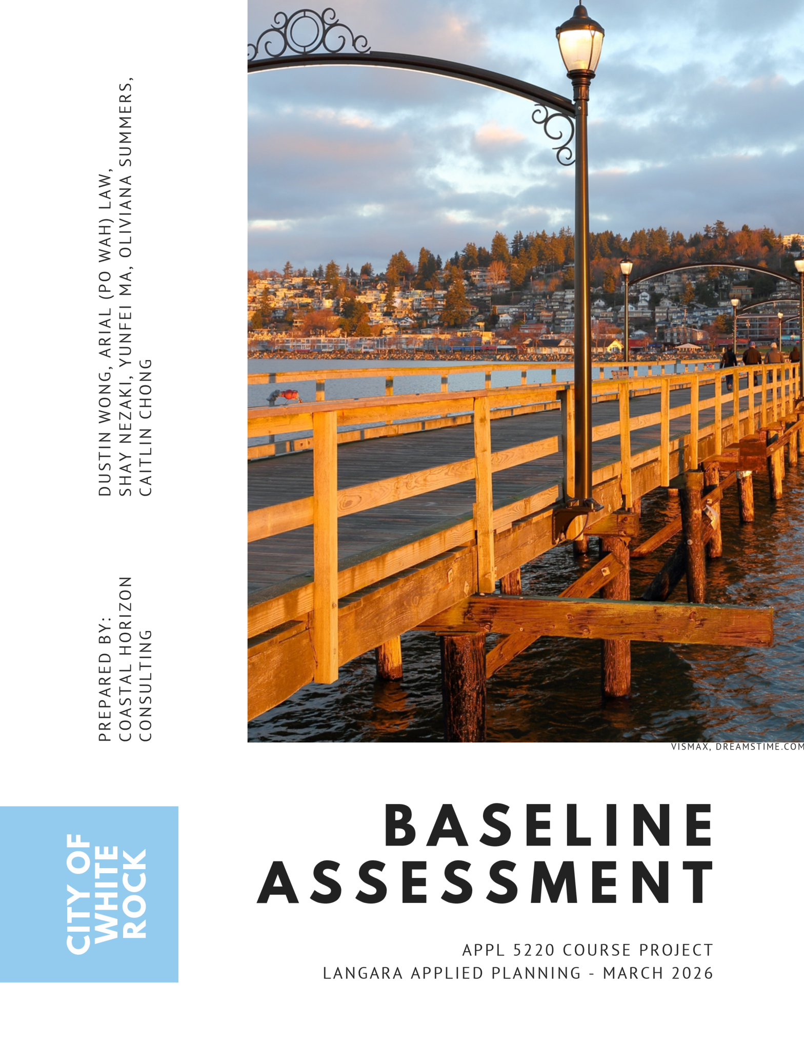
A hypothetical baseline assessment for a future OCP update at the City of White Rock.
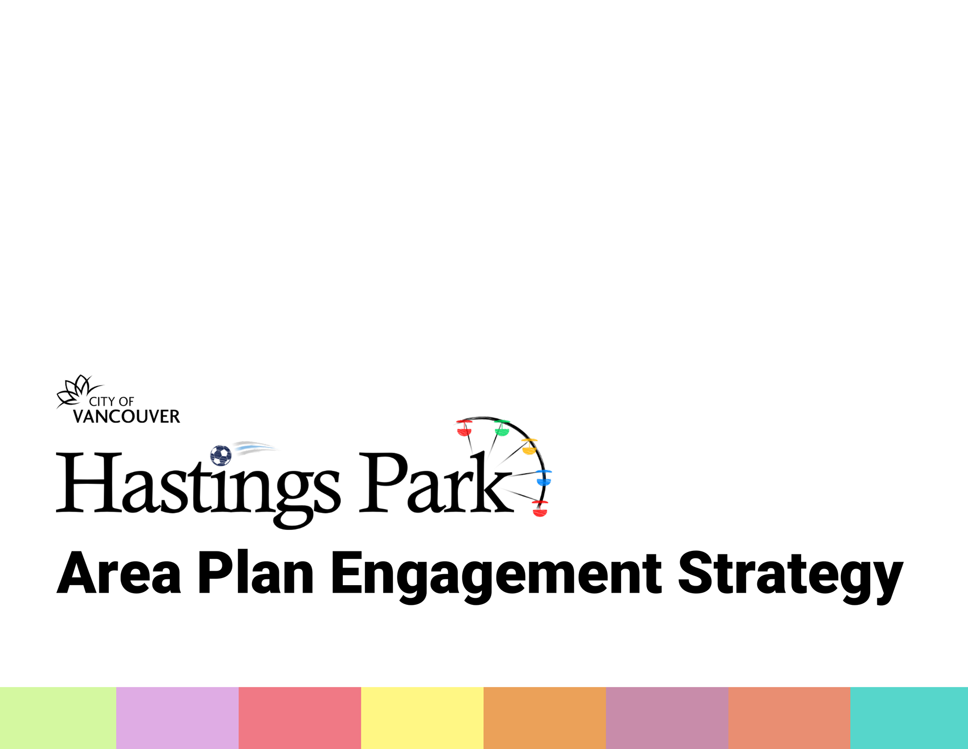
A hypothetical public engagement strategy for the future entertainment district redevelopment of Hastings Park in Vancouver.
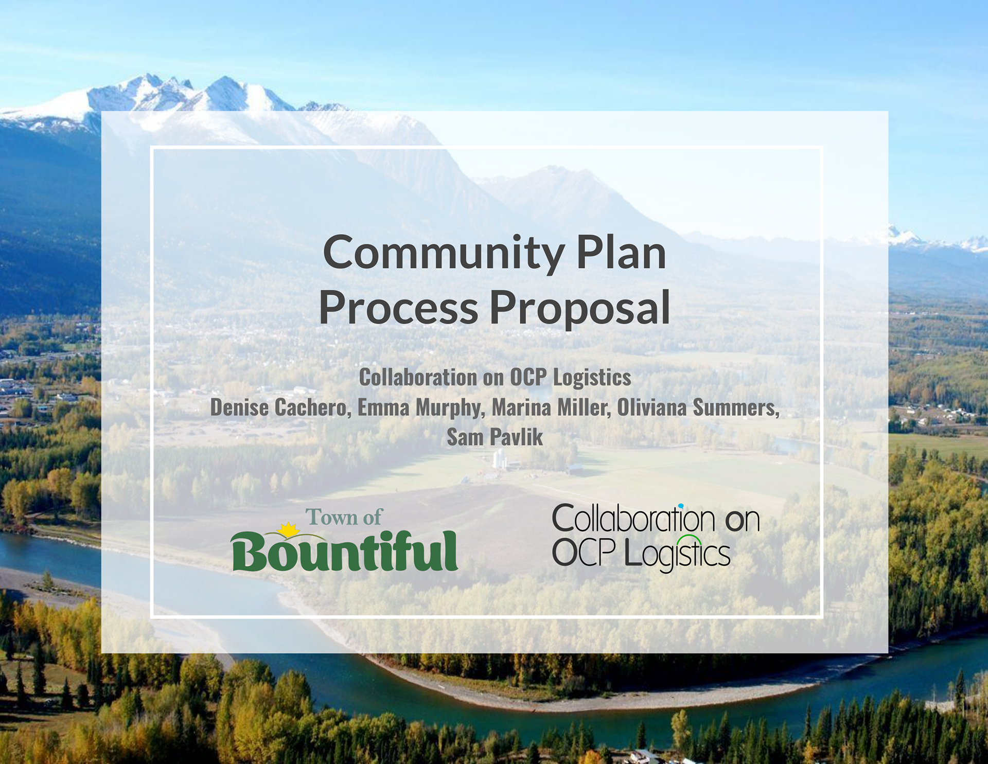
A hypothetical response to an RFP for an OCP development within the imaginary Town of Bountiful.
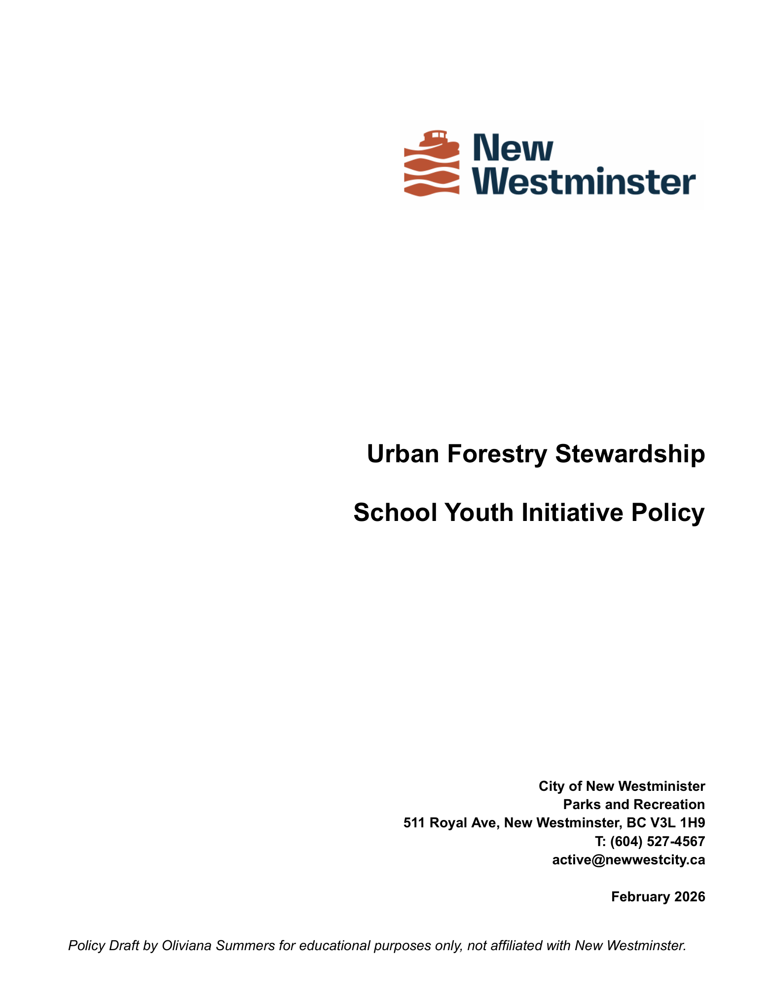
A hypothetical policy draft plan considering how to engage youth in urban forestry stewardship within the City of New Westminster.
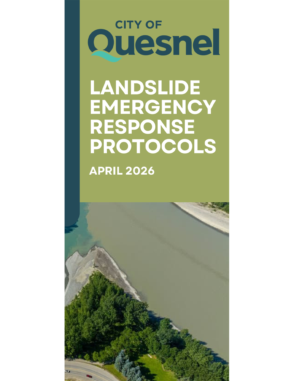
A tri-fold brochure intended to inform Quesnel residents on current landslide related emergency information.
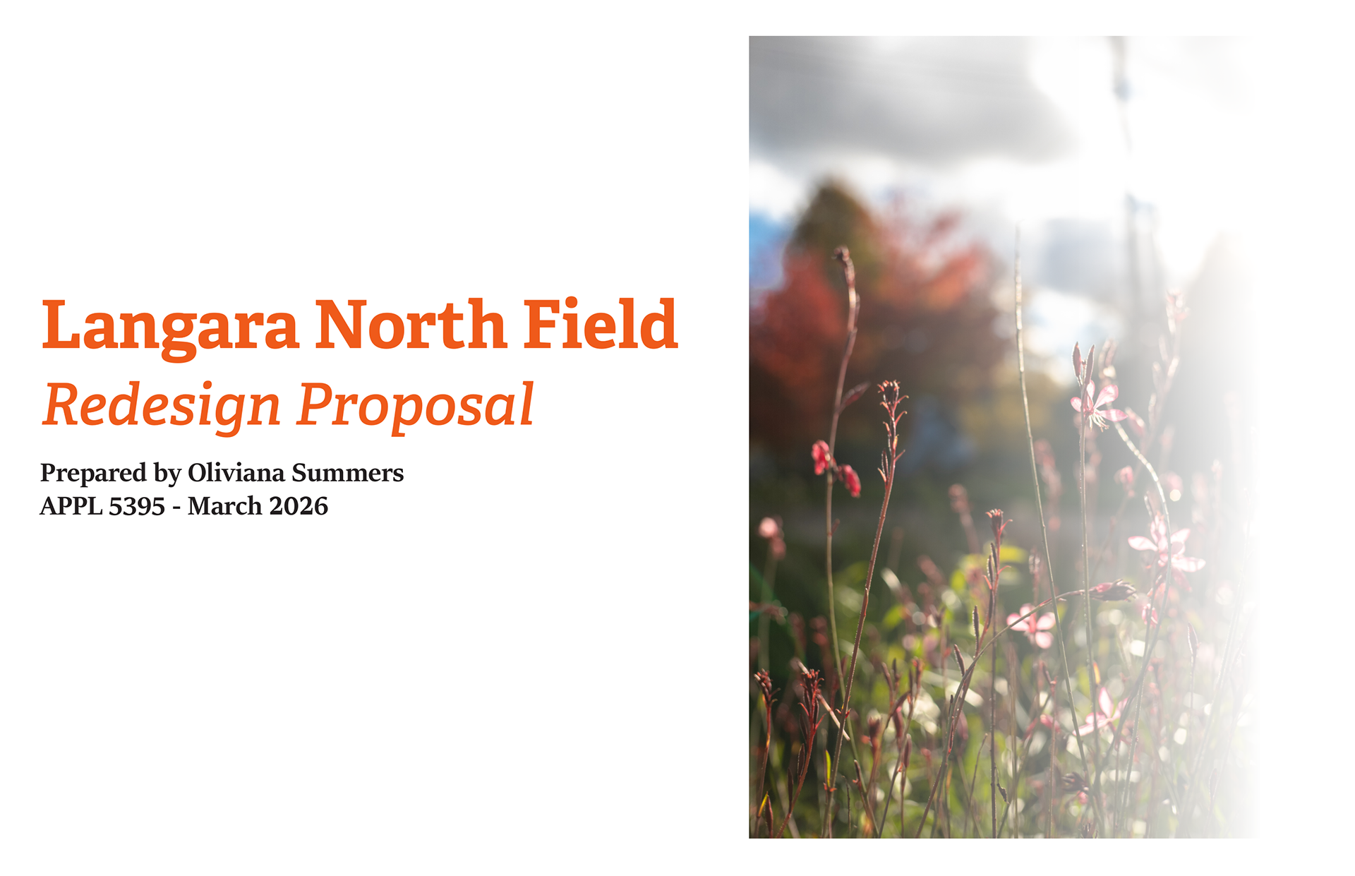
A hypothetical proposal for a redesign of the vacant north field on the main Vancouver campus of Langara College.
If you're interested, I'm also a photographer.
Click the link below to see that portfolio.
Click the link below to see that portfolio.
All works presented are the intellectual property of Oliviana Summers. Do not distribute.